Science: Estuary and Nearshore Changes
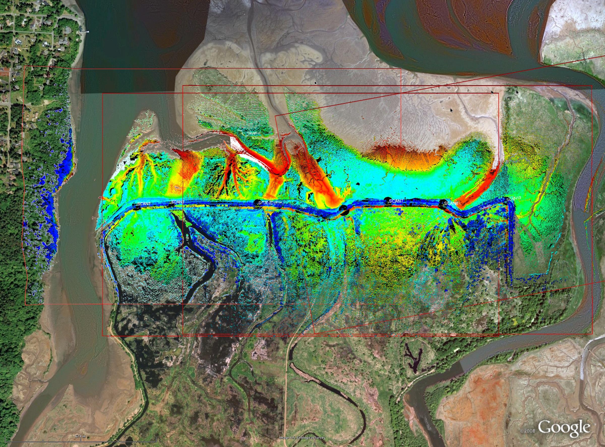
Nisqually Delta LiDAR Survey Data: Full size image (1 MB) | Google Earth KMZ (2.3 MB)
Study conducted by Dr. Robert Kayen, USGS
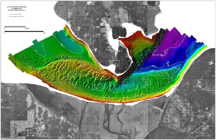
In addition to the project area itself, restoration will have effects on the greater estuary and nearshore habitats. Working in cooperation with the USGS Pacific Science Center (E. Grossman), we will examine the changes in the estuary following restoration of the project site. The estuary studies will include mapping of nearshore topography and habitats, hydrologic processes controlling fluvial and tidal flow, and estuarine mixing and sediment and nutrient transport to relate to changes in ecosystem response. High-resolution LIDAR mapping will be conducted at 2-3 sites in the Nisqually Delta where dike removal is planned. These data will serve as essential baseline data to examine geomorphic change, sediment transport, and numerical sediment transport modeling with dike removal. Sediments will be collected from behind the dike and offshore areas across the tide flats, where channel formation with dike removal will erode and redistribute sediments. We will obtain a snapshot of changes in substrate type, sediment grain size, sedimentary organic matter, sedimentary nutrient and contaminant composition, micro- and macrofauna and overall rates and modes of sediment transport through repeat sampling following dike removal. Boat-mounted ADCP (Acoustic Doppler Current Profiling) will be conducted at select sites across the nearshore tide flats and newly restored channels to characterize circulation patterns before and after dike removal. These data will help characterize processes controlling sediment transport and be valuable for testing numerical circulation model simulations, including the hydrodynamic and sediment transport (HST) model developed to assess design alternatives (ENSR 1999).
Sampling of the greater estuary would include: 1) LiDAR surveys at least 1 time at 2-3 new channels behind and in front of the dike; 2) sediment sampling at 3-5 sites along a cross shore transect per new channel (n=2 or 3) before and after dike removal; and 3) current measurements, 3-5 transects repeated over the spring tide range before and after dike removal but at similar river discharge and wind conditions.